Routeburn Track
In October 2016, we were planning our Christmas travel and we decided to take the advantage of being down in South Island and do another Great Walk. After Tongariro Northern Circuit it was going to be our second one. As the Kepler Track hut tickets were already sold out for suitable dates and the Milford Track was hopelessly booked out for the rest of the season, we chose the Routeburn track..

The Routeburn track is a one-way walk, so after deciding which way we would go, we needed to sort out our transportation. We started the track from The Divide and finished it at Routeburn Shelter. We considered different options, compared prices and eventually chose car relocation with Easy Hike.
The night before the track we stayed in Te Anau. In the morning, we went to do some final shopping and picked up a locker for a car key. We’d never done this type of car relocation before and after we got a little magnetic box which we supposed to snap to the bottom of the car, we could do nothing but hope that we would see our car ever again.
The weather in Te Anau wasn’t bad but as we were getting closer to The Divide, the surrounding hills got covered by clouds and it started to drizzle a bit.
We set off the track shortly after noon. Over the night, we were going to stay at Lake Mackenzie campsite which was about 4 hours of walk away. No need to rush then.
The track ascended gradually and in 45 min we came to the junction to Key Summit. That is said to be a popular side track with a beautiful view but as the visibility was poor that day, we skipped it and carried on to Lake Howden.
On the bench, in front of the hut at Lake Howden, we had a small snack. But shortly we rather carried on moving because a big guided group of people was just about finishing their fancy muffins and got ready to go too and we wanted to avoid any walking in queues.
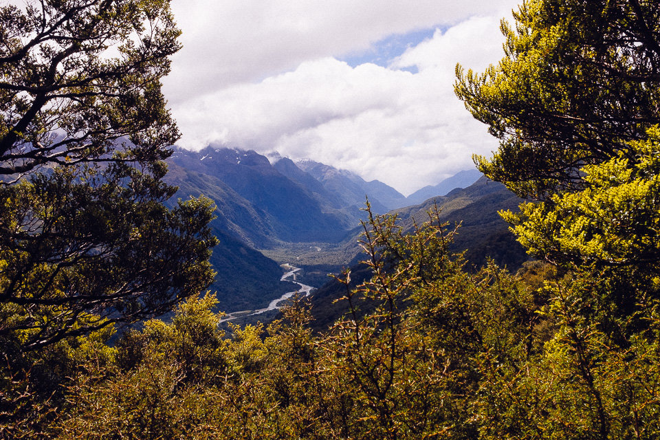
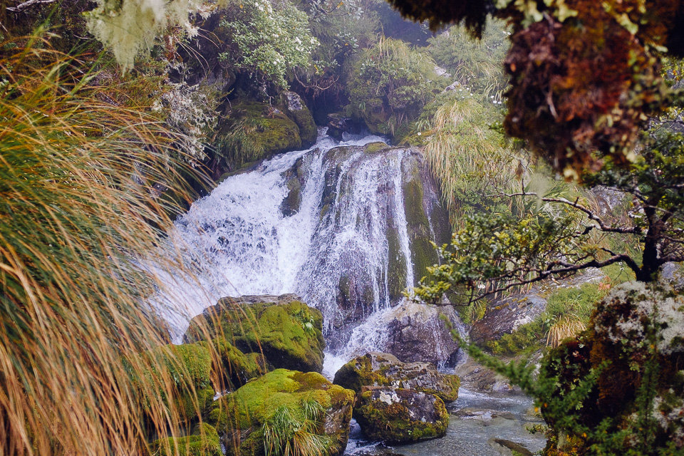
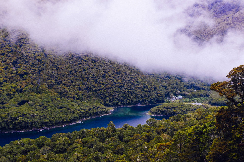
Along the next section of the track, the clouds cleared up a bit now and then and we had a better view of hills on the other side of Hollyford valley. Unfortunately, just when we reached the Earland Falls one of the clouds covered the mountain and we could hardly see the top of the waterfall.
On the other hand, when we reached an open grassy area called “Orchard” even sun came out and we could fully enjoy the sunshine. The Orchard looked like an amazing place for camping but “No Camping” signs are located at both ends of this lovely section.
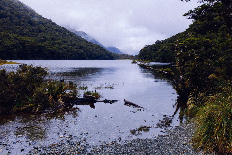
At Lake Mackenzie, we arrived at the hut first. The campsite was located about 10 minutes further but notes around the hut clearly informed that campers are not allowed to use hut facilities. We were a bit surprised by such a differentiation between campers and hut guests. Especially because during our time at Tongariro Northern Circuit we stayed at the campsite but we were allowed to use the huts for cooking or chilling.
At the campsite, there was only one other tent but by the dusk, the area was fully packed.
Before dinner, we explored the area around the lake. There is a short side trip to Split Rock. From the rock, the orange triangle signs led to the edge of the lake. The path was a bit overgrown and sometimes we had to struggle through branches but it was worth it because the lake shore was charming.
The next day morning we set off early as we were going to finish the rest of the track and still had planned to drive a bit further north before we would find a campsite for the night.
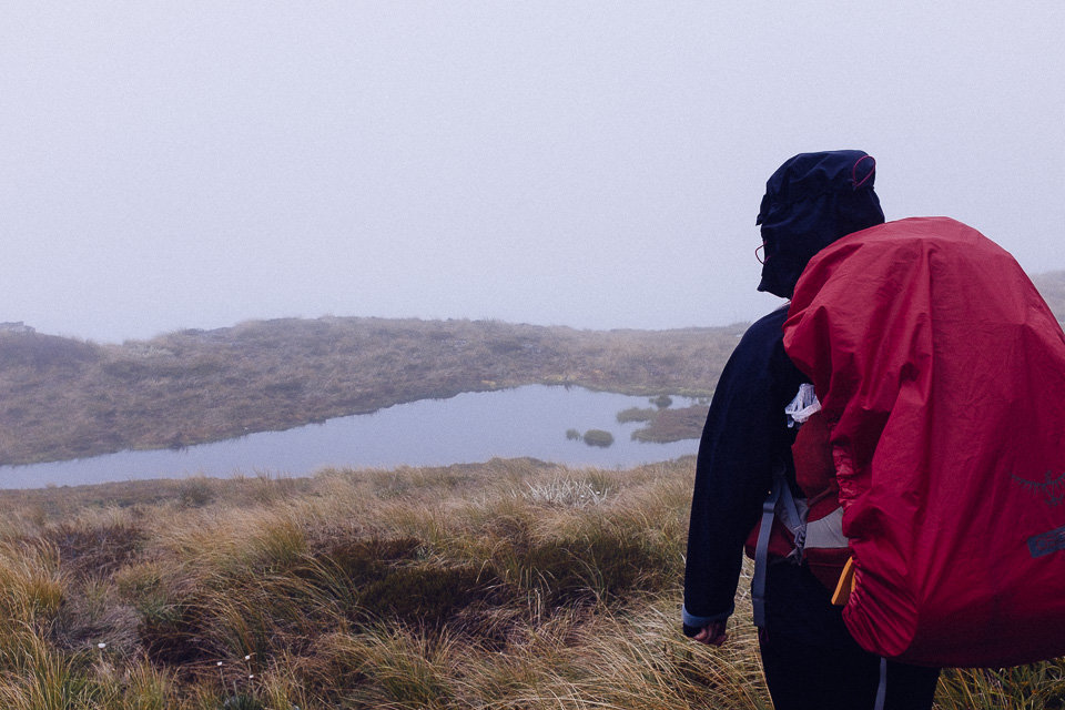
The section from Lake Mackenzie up to the hill was the only arduous ascend on the track. But once we climbed to a certain level, we easily traversed the exposed Hollyford Face. In good weather, according to our guide book, this part provides wonderful views over the Darran Mountains. Unfortunately, we walked in a total fog and didn’t see further than a few meters.
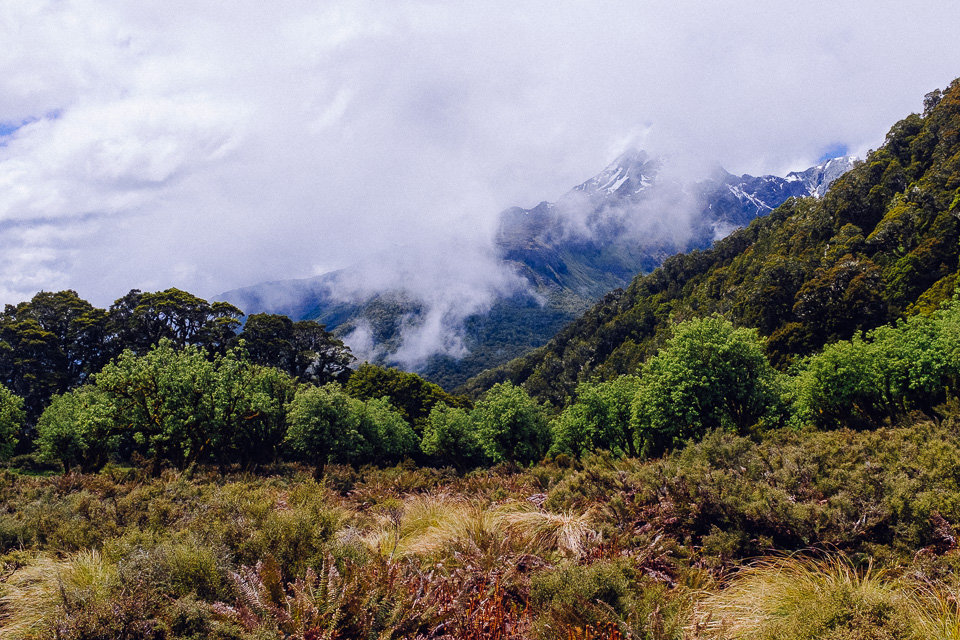
Then we passed Harris Saddle and on the other side of the ridge, the situation got finally better because all the clouds were caught by hills. There was a small shelter at Harris Saddle which was an ideal place for a snack.
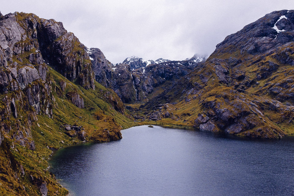
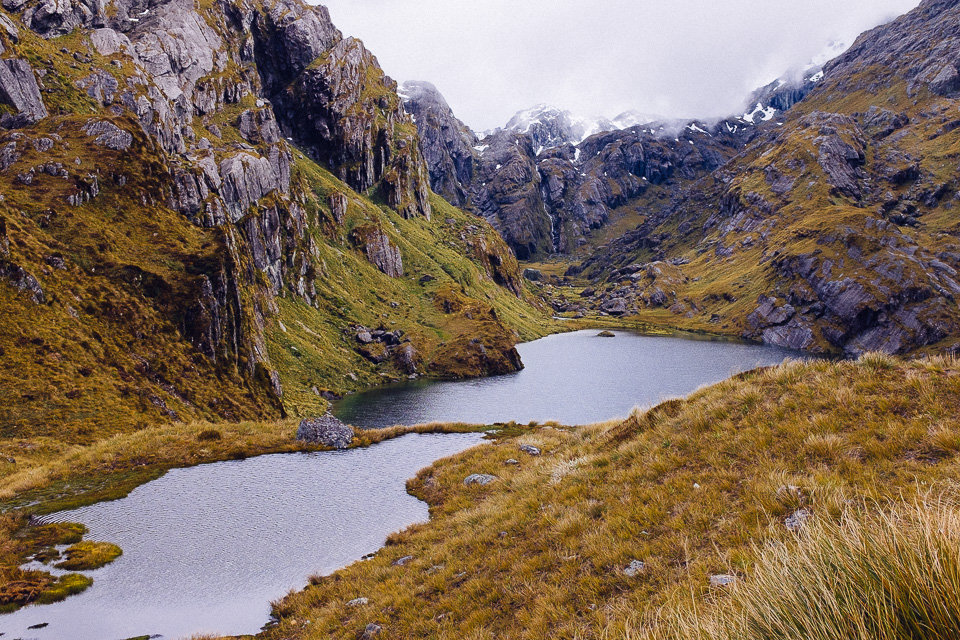
The following section of the track was really stunning. The track ran above black waters of Lake Harris and we enjoyed views of jagged mountains all around. Further behind the lake, we could see a high waterfall falling out from Lake Wilson.
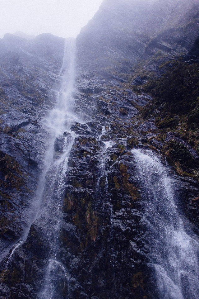
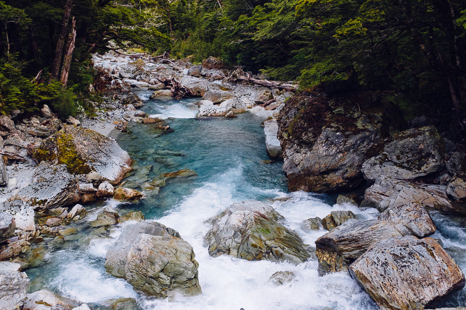
On the way down to Routeburn Falls Hut, we descended along a cascading stream which escalated into an impressive gorge and a beautiful combination of waterfalls right next to the hut. The hut was almost empty as all the people left already and we had a quiet lunch in a communal kitchen.

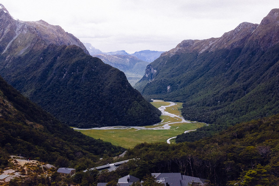
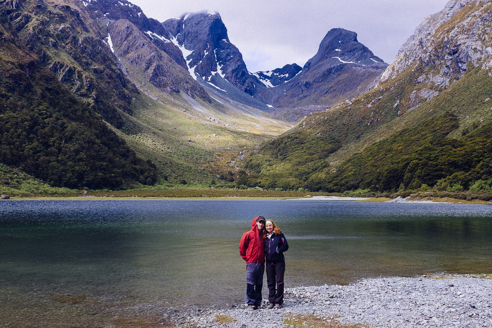
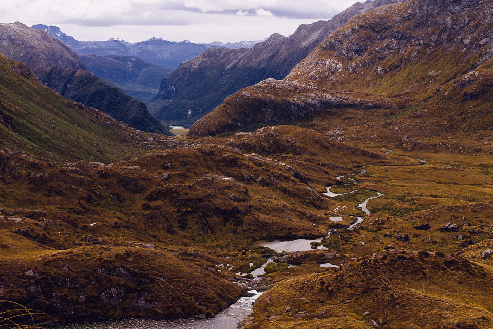
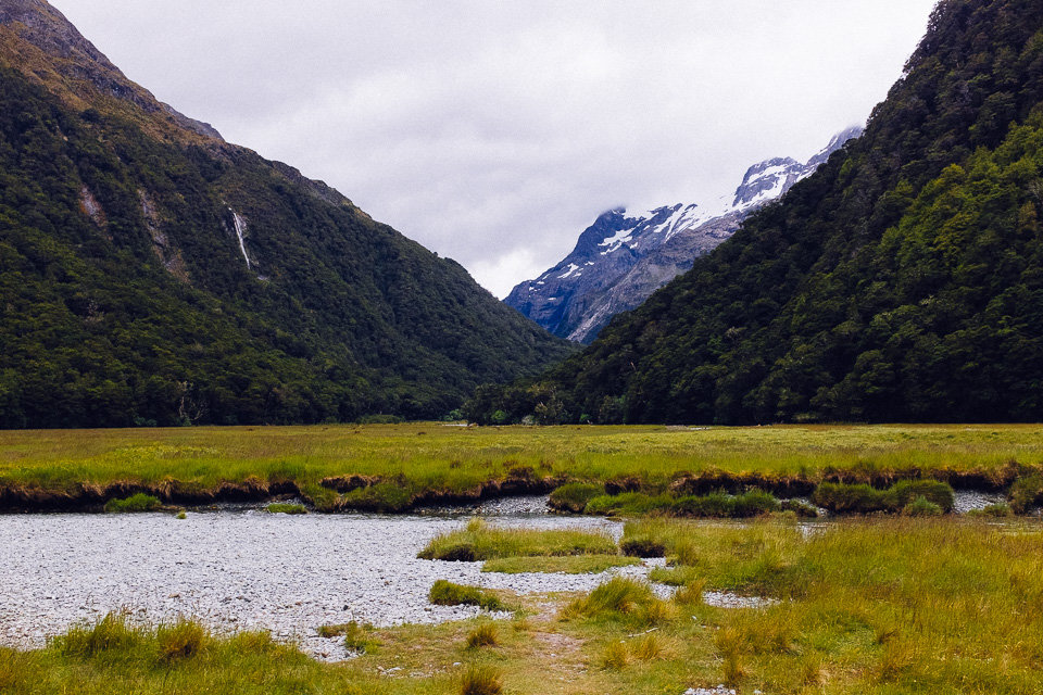
From Routeburn Falls Hut we descended steadily through beech forest and passed a few small waterfalls before we made a turn to Routeburn Flats Hut – our last stop on the track. The hut was on the edge of open grassy area with access to the river and views of the Humboldt Mountains
The rest of the track ran through the forest along the open area before it went over a swing bridge and then it winded above the gorge. Frankly, that section was a bit tedious and too long, so we were quite happy when we finally reached the carpark after a couple of hours.
But we were even happier when we saw our relocated car!