Avalanche Peak and autumn in Arthur's Pass
It’s a while ago when one of our friends moved from Wellington down to Christchurch and left his car with us. He asked us if we could drive it down during one of our trip and so we did.
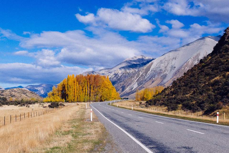
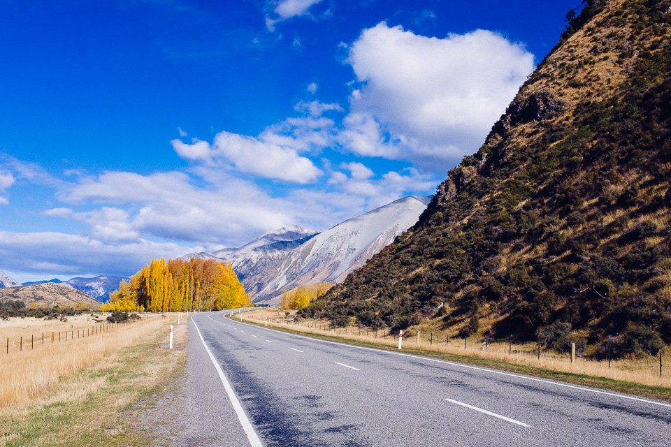
We booked the ferry and planned to make a stop in Arthur’s Pass on the way to Christchurch. So far, we only had done some small walks in the area and were keen to do some of longer hikes.
The ferry anchored in Picton and we carried out via Nelson Lakes to Murchison and than down south to Jackson where we book accommodation at Jackson’s Retreat Alpine holiday park. This place is beside a wonderful forest with options for short walks and a few glow worm spots. The park’s communal areas are well equipped and everything was super clean. Furthermore the owners had a goat strolling around park and let everybody to rub it.
Next day morning we moved on to Arthur’s Pass and went to a local DOC office to get more information about hiking options and also to ask about the latest weather forecast.

As the forecast said the morning clouds should clear out later in the day, we decided to climb up to Avalanche Peak and return via Scotts Track. The entire walk was estimated to take between 6 and 8 hours, so we packed our backpacks and set off.
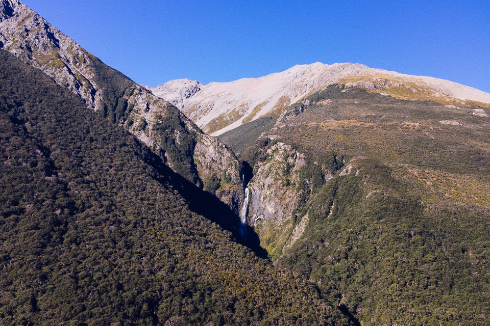
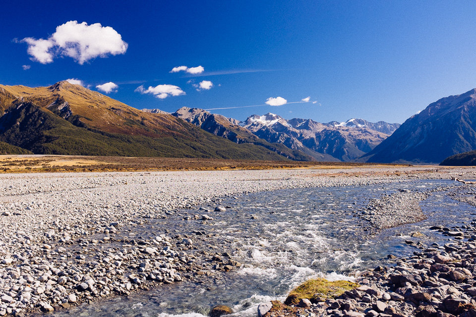
With no easy warm up, the track immediately started to climb up. More than once we had to use our hands to swing up large steps. As we ascended through the forest, we could see waterfalls along Avalanche Creek every now and then. We made a few short breaks but after an hour or so, we finally made it to the bushline.
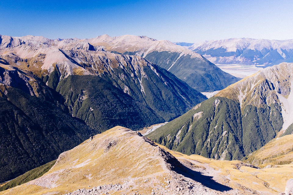
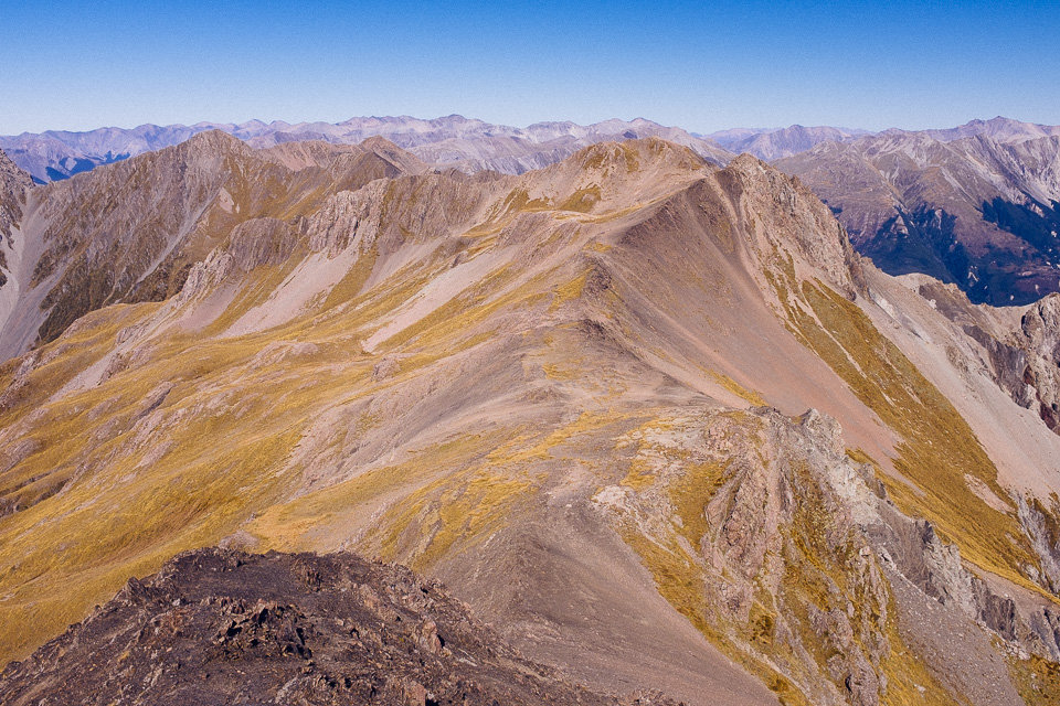
Even from here views were amazing but we still had about 700m of elevation ahead of us. From this point the track followed the ridge line and every moment we stopped and turned back to have a look around.
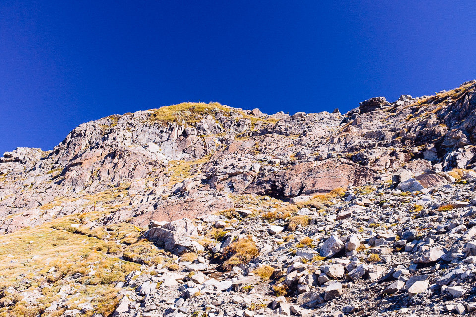
A couple of hundred meters below the summit the ridge flattened so our legs could have a rest before the final part. It wasn’t my favourite section because we had to climb up through bluffs with sheer slopes either side.
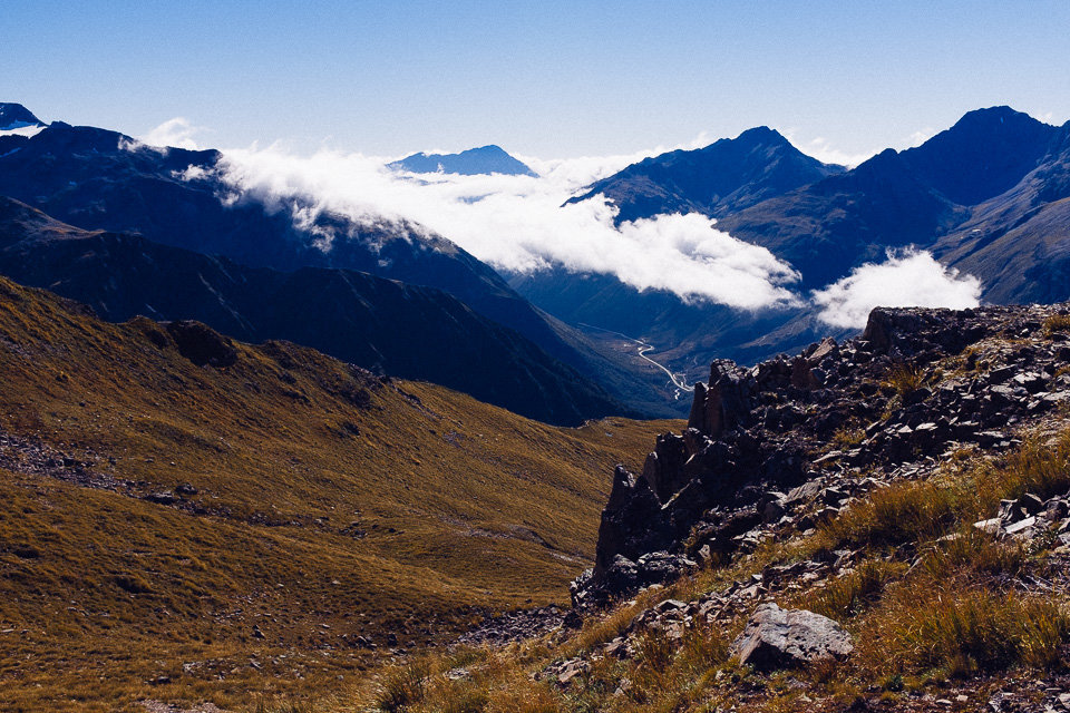
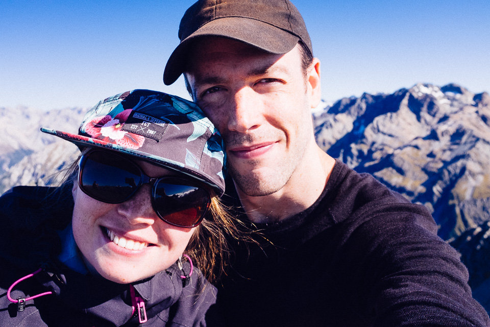
However, our effort was rewarded with an amazing 360° view. The sky was clear without a single cloud and some of shaded hills were still covered by snow patches. With such views our summit lunch tasted much better.
After resting and taking enough pictures we headed back to Arthur’s Pass via Scott’s track. As the track path runs along the neighbouring ridge, we could enjoy the views before we got below bush line. The track was also considerably less steep then the one we had climbed on the way up.
A couple times we could see Devils Punchbowl Falls through clearings in the bush on the other side of the valley. After an hour we met the main road and it took about extra 10 minutes to get back to our car parked near visitor centre.
It would not be a proper hike without a treat at the end so we grabbed a scoop of ice-cream at a local cafe. After that we could head off to Christchurch and hand the car over.