New Caledonia: lush rain forest and desolated mines of East Coast
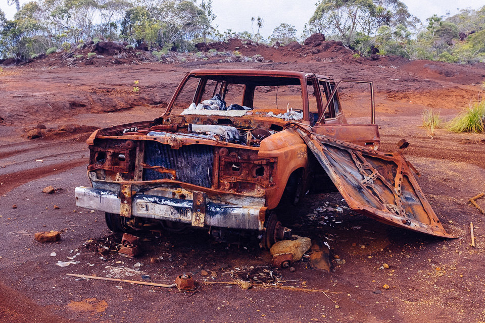
In morning, we left Koumac and drove across the top of the island towards. A surrounding land was covered with half-dead trees sticking out of charcoal coloured soil. The vegetation was very sparse in this part of country. We passed a worryingly high number of car wrecks along the road. Some were remains of car accident but others were probably just dumped there to get rid of an useless vehicle.
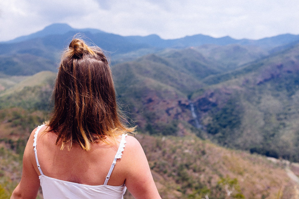
In the past, this part of island was a significant mining region but it also left its marks on landscape and we were wondering how many tourist get around. Those views were not from a travel brochure.
However, once we got to Ouegoa – a historical copper and gold rush town – and near the coast, the amount of rainfall got higher and everything was greener. We stopped at a couple of desolate beaches. The views of palm trees bending down water and rapidly rising hillsides were spectacular. We had a quick dip in the ocean but then moved on to the next stop – Tao waterfall.

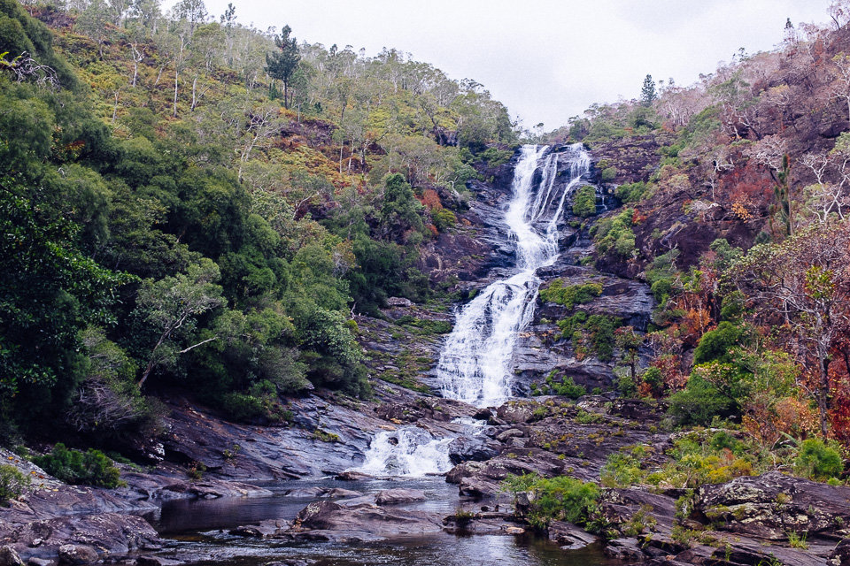
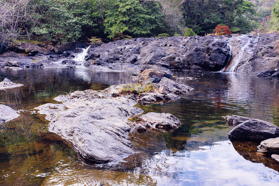
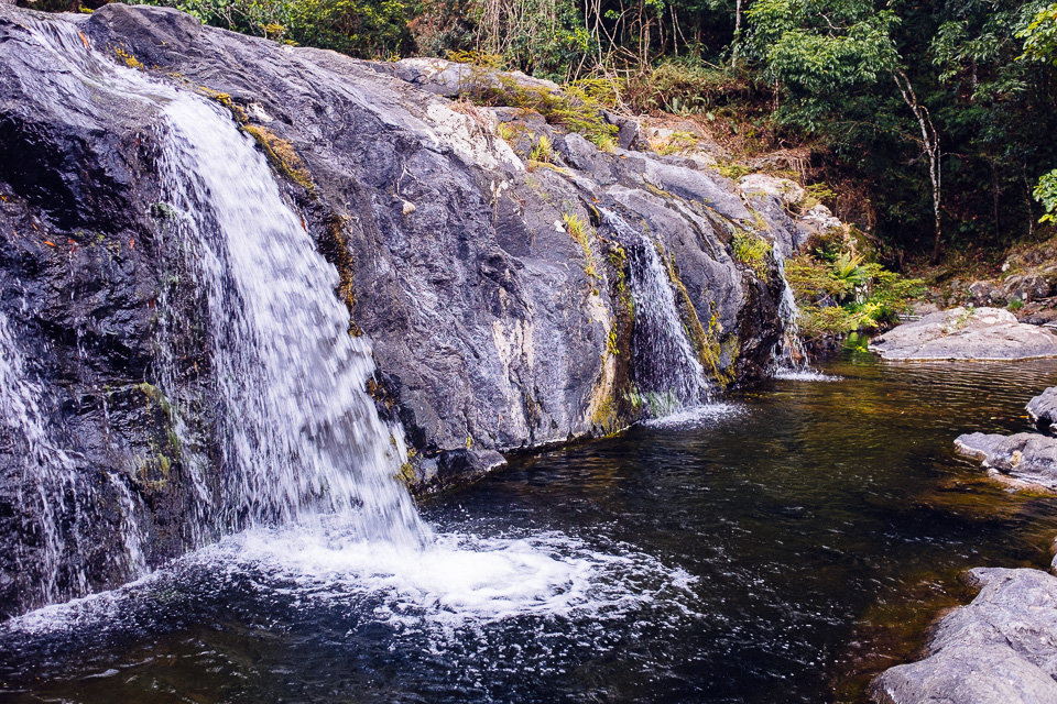
There were many waterfalls along the road but this one was easily accessible from and was definitely worth stopping by. We spent there a good half an hour hopping from boulder to boulder and dipping in clean water.
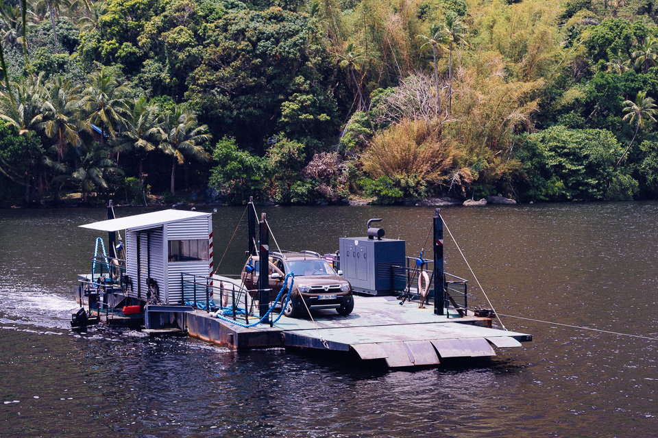
When we got back to the car we carried on to Ouaième ferry. It is the last working Caledonian ferry and should be soon replaced by a bridge. The ferry was small and fitted only a couple of vehicles but operates 24/7 and it was free.
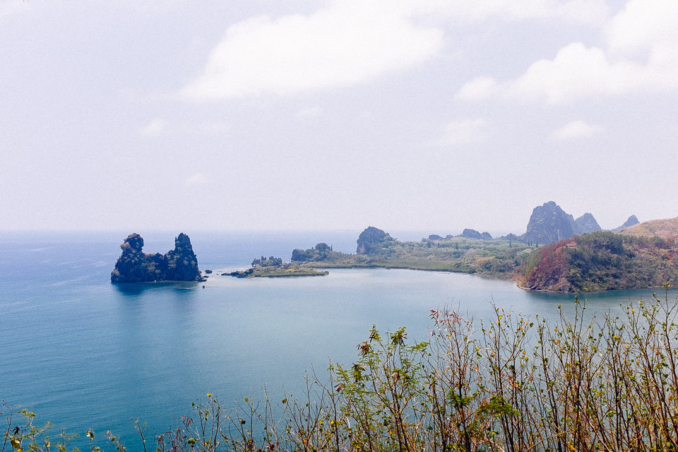
We arrived in Hienghene, where we made our next stop. The town is located on the edge of Hienghene river mouth and is popular for its limestone rock formation called La Poule. The stone which sits in the lagoon is easily spotted from lookouts along the road or there was an option to hire a kayak and paddle around. But we skipped that and after a lunch we moved on.
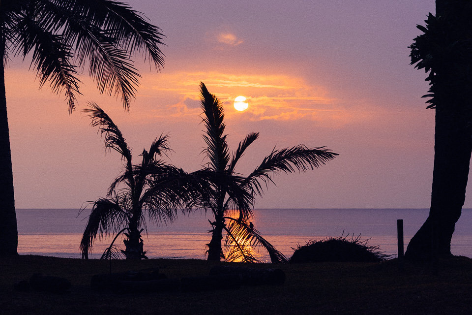
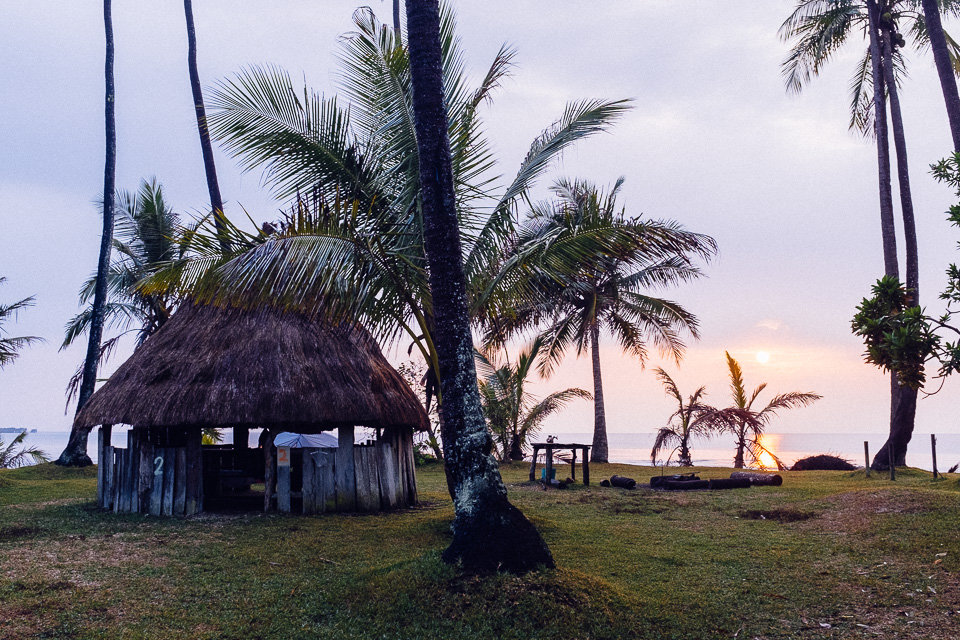
It took us a couple more hours before we arrived in Port De Poindimié where we were going to stay over the night. The Camp De Tiakan was an amazing spot situated in a palm grove right next to the beach. The only worry was not being hit by falling coconuts. We picked a site with a view of ocean and in the evening we watched the sunset while having dinner. It was definitely the best campsite during our stay in Caledonia. Basic but beautiful and clean.
In the morning, we had to set off early as there was a lot of driving and we had to get back on west coast. Before we left the coast and started to go up to the central mountain range we had stopped at Ba waterfall near Meomo village. The waterfall was off the main road and an access path to it looked a bit dodgy. But luckily nobody kicked us out.
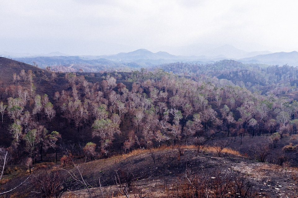
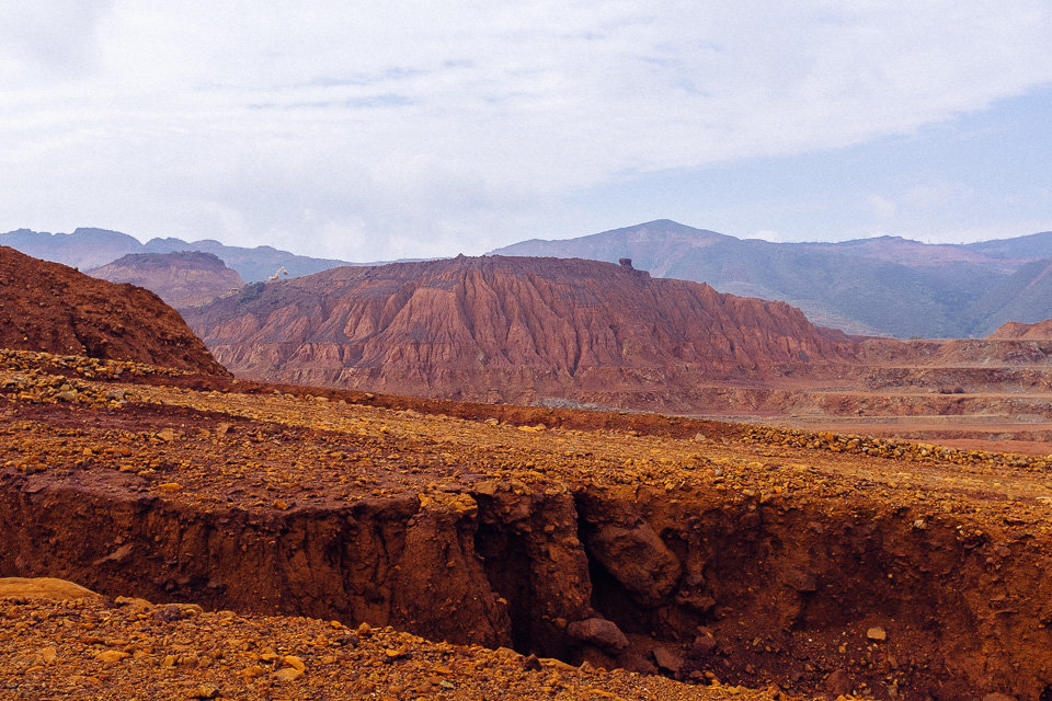
From Poro the road started to climb up and we entered the mining region again. In this part of the country, the mining of nickel has been going on since 1980s’. The landscape there looked terrible, especially in the contrast with the fresh and green upper east coast we had just came from. Down here, there was no vegetation. The dry red soil was separated by deep gullies modelled by erosion. Now and then we could see large diggers operating in the distance.
At one point we got a bit nervous about the lack of petrol in our car. The car fuel consumption was quite high in the hills and no petrol station was anywhere near. And we definitely didn’t want to be stuck here. Luckily, we soon passed the summit and slowly descended to west coast.
Before we reached the coast, we had made a turn to a small town called Farino where we wanted to visit a giant fern park. Unfortunately, a hunting had been in progress and people were not let in due to safety reasons. Then we had to be happy with a near walk to a Farino waterfall. The easy trail followed the bank of the creak before reaching a small waterfall. A whole way a dog accompanied us as a local guide.
When we got back to the carpark it was late afternoon and we still had a couple of hours of driving ahead of us. Once we reached the west coast we merge into highway and the rest of the way passed much quicker. Just before the dusk we arrived in Dumbea where we stayed over the night. The Gaia Pacific campsite was basic but clean and quiet place. Apart from us, there were only two more tents.
Stay tuned as the next destination will be – the Great South!