Kepler Track
Most of the Great Walks need to be planned well ahead and the same stands for the Kepler Track which is one of them. It is the 3-4 day walk, so we booked our hut tickets already in October for a long weekend in January. Unfortunately, campsites, which count for a cheaper accommodation option on Great Walks, are not well spread along the Kepler Track. Given the fortune we spent for hut tickets and flights, we really hoped for good weather, despite the bad weather forecast.
On Friday we walked through the airport gate without any troubles even though our carry on backpacks weighed a bit over 7kg. Luckily, nobody checked that.
In Dunedin, we picked up our El Cheapo from Jucy and carried on to Balclutha where we were going to stay the night. We knew about a nice camp there as we’d already stayed there during our Christmas travel.
The next day, when we approached Te Anau, the surrounding hills were covered by clouds. Once it started to drizzle, our last hopes for good weather had just vanished.
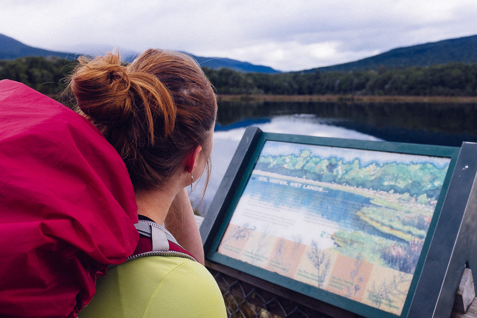
In Te Anau, we walked to DOC center to pick up hut tickets and get their latest weather advice. It wasn’t good at all. A lot of rain and strong wind but apparently not bad enough to close the track.
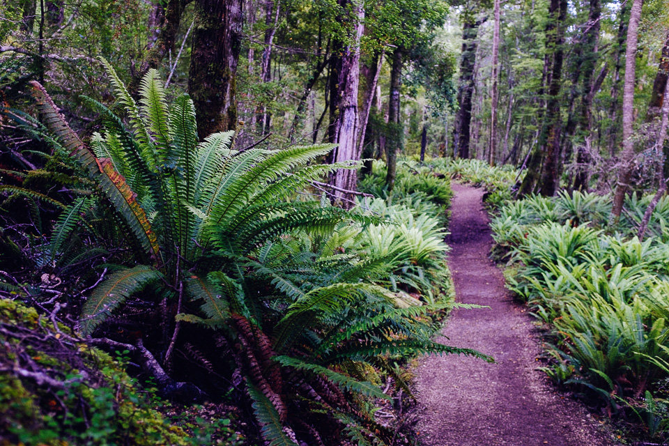
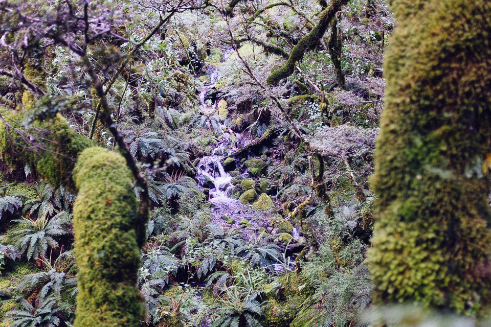
So, we headed off. The first part of the track ran through beech forest along the shore of Lake Te Anau. At Brod Bay campsite the track turned away from the lake and we started to climb up. I was annoyed. All that effort ahead and money we spent for nothing. No more than rubbish views and wet clothes. After a while, my mumbling and complaining annoyed even Jakub. Moreover, blisters appeared on my heels. On the first day. Perfect!
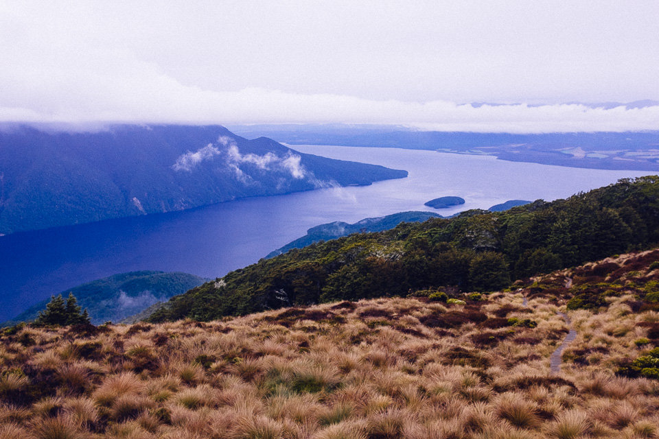
We passed a massive limestone bluff before we got above bushline. It was a moment when we should have enjoyed panoramic views. What we really experienced was total mist and views of few meters around.

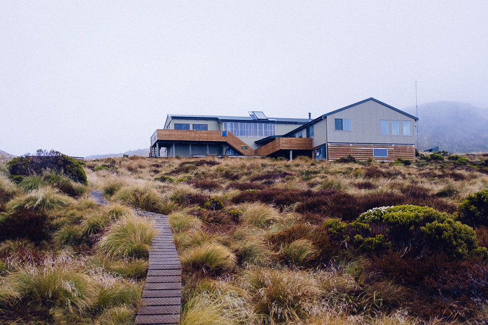
After about 45 minutes we reached the Luxmore Hut. While having a snack we got a bit warm and as there still was plenty of daylight we went to explore Luxmore Caves which were nearby. A few stairs led down to the cave entrance and with a torch we could go quite deep into the cave. Definitely worth those 10 minutes walk from the hut.
During the evening the clouds raised up and we had a better view of the lake Te Anau and surrounding hills. However, a hut ranger didn’t put our hopes for better weather too high during his evening hut talk.
In the morning, he confirmed his predictions with the comment “It’s pretty brutal up there.” and added that groups with young kids should consider returning back to Te Anau.
After thinking it through over the breakfast and reassuring with the ranger twice that it would be tough but not dangerous, we set out ahead.

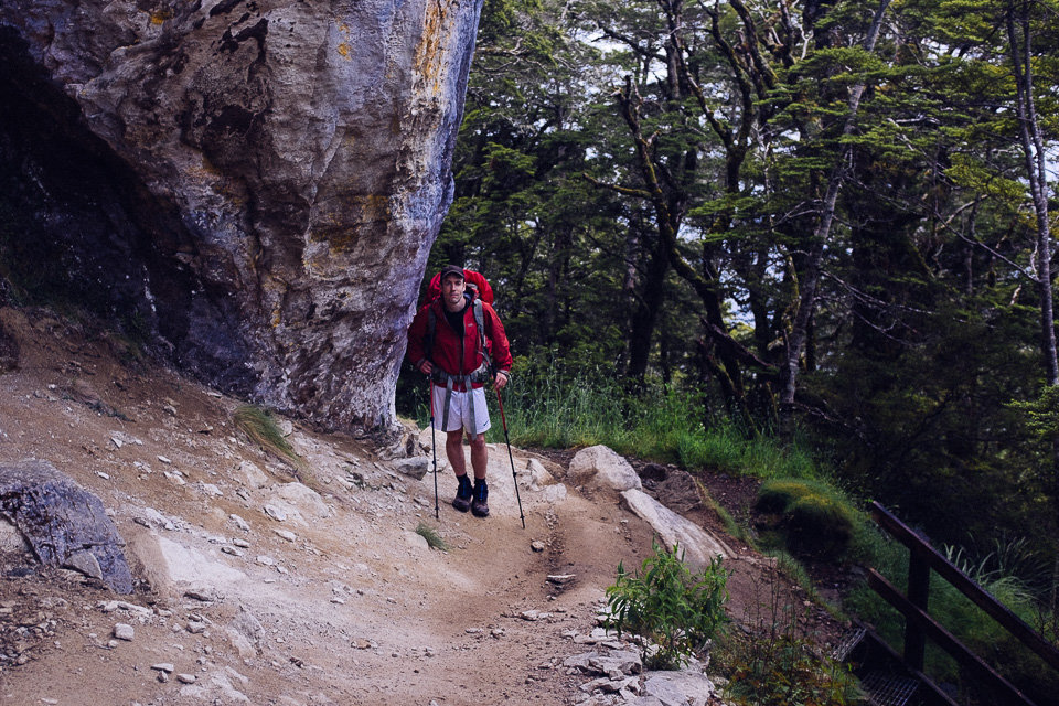
Once we left the hut, a cold wind hit our faces. It was strong but luckily most of the time we were sheltered behind the ridge. We rejected a side climb to Mt Luxmore summit and headed to the Forest Burn Shelter instead. On the way, we passed a number of other people and surprisingly even a group with small kids.
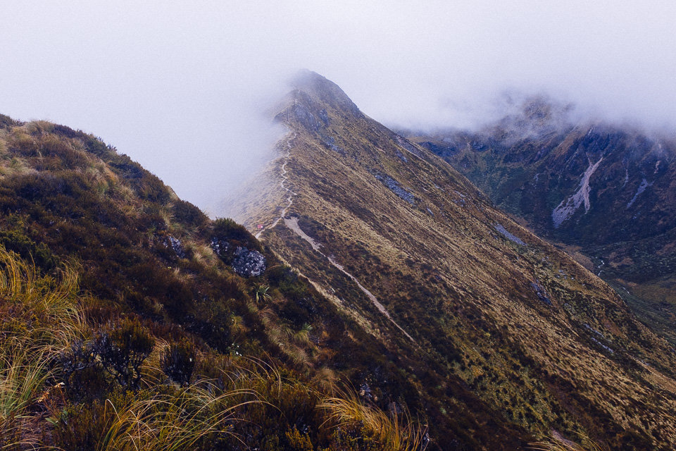
The section between Forest Burn Shelter and Hanging Valley Shelter was rough. There were patches of snow on the path, it started to rain (horizontally thanks to the wind) and the temperature dropped down below zero due to wind chill factor. My trousers were covered with an icy crust.
The worst part was when we were passing one of the exposed saddles. The strong wind that rushed up through the valley along with gusts with speed over 100km/h made it really hard to stand on the narrow pathway. In the middle of the crossing, I suddenly saw Jakub’s backpack cover being blown away. At that point, I was quite scared and was thinking about going back.
However, when we got over that section the conditions calmed down a bit and we reached the Hanging Valley Shelter in about 10 minutes. There, we met a couple who came from the other side of the track and they assured us the wind wasn’t so bad over there.
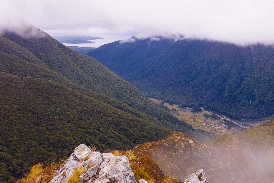
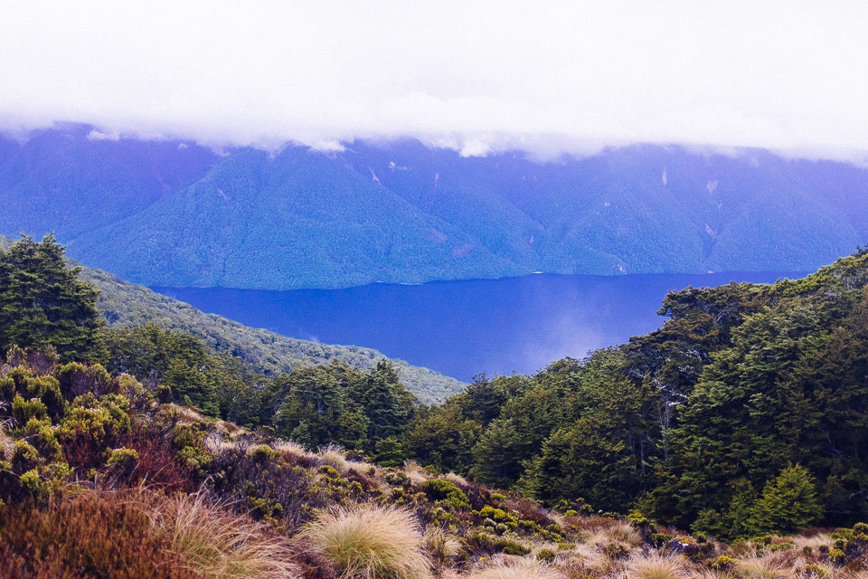
In fact, the following part when we descended along the ridge to the Iris Burn Hut provided some good views of the valley and Lake Manapouri. Finally, the more pleasant half of the track began.
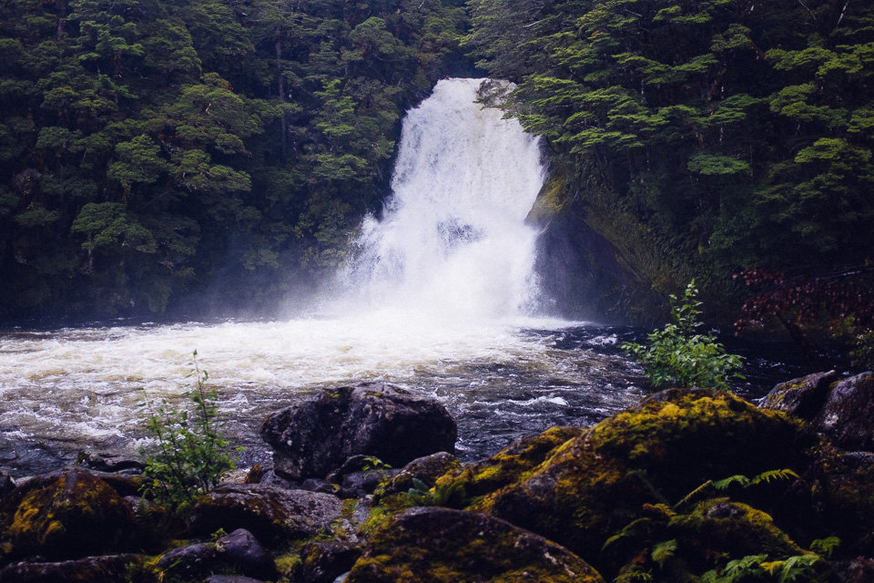
The Iris Burn Hut was situated in a large tussock clearing and there were no signs of terrible weather which troubled us on the ridge. Inside the hut, a wood burner made it nice and warm. Refreshed and with dry clothes, we went to Iris Burn falls which was a 20 minutes side trip from the hut.
A guide leaflet referred to the waterfall as a place suitable for a dip but after plenty of rain in the last few days, the waterfall was a quite massive and too whirling even for famous blue ducks.

In the evening we listened to an interesting hut talk during which a ranger tried to imitate sounds of kiwi. His performance was a bit weird but it was authentic enough that later in the night when I woke up and heard a similar noise I knew it was a kiwi out there. Yeah!
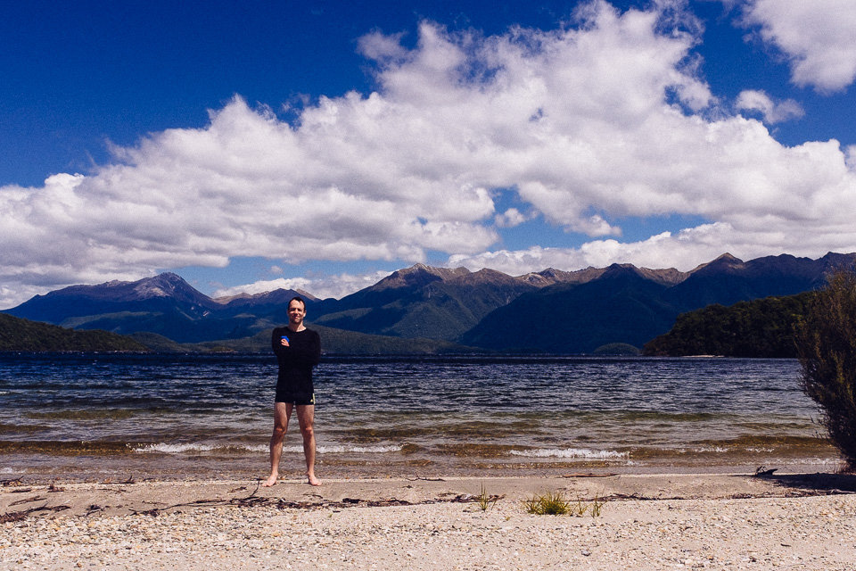
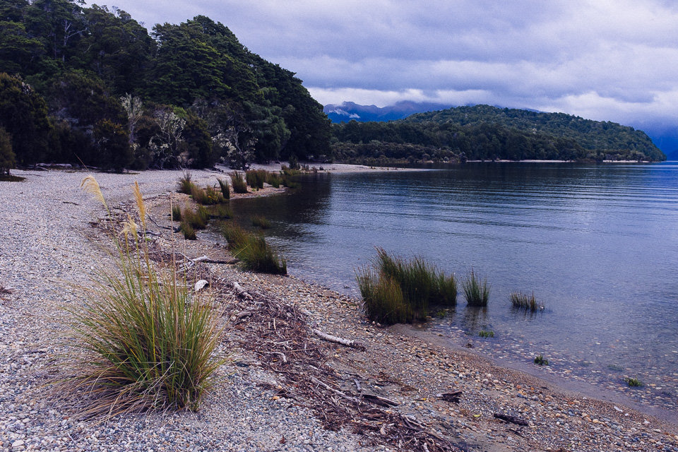
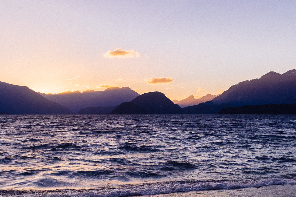
The next day the track took us over an easily graded saddle, we passed a location where heavy rains caused a large slip in January 1984 before walked through lowland beech forest. We were almost eaten by sand flies during our lunch on side of Iris Burn. Early in the afternoon, we reached the shore of Lake Manapouri. While Jakub was having a refreshing dip, I enjoyed the sunshine. The Moturau Hut was located only a few hundred meters further and in the evening we observed a beautiful sunset over the lake on the beach.
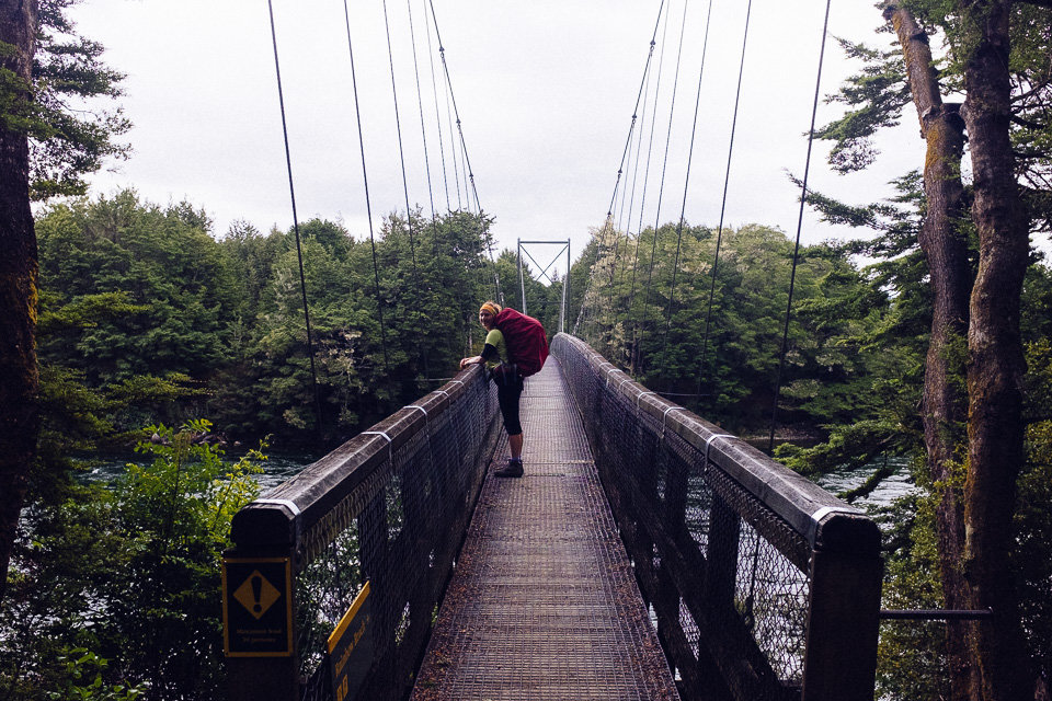
Last day was a bit struggle as our legs were wobbly after previous 3 days and 45km. The section walked across flat wetland and then followed the Waiau River. From swing bridge at Rainbow Reach, which was an optional end of the track, we still had 10km to finish the track. Despite aching feet, we refused to take a shuttle, clenched our teeth and carried on.
It was a real relief when we finally passed control gates at Te Anau Lake and got to our car after four days.
Eventually, the trip was not a waste of money. Those four days had everything – a lot of rain and a bit of sun, some wind and frost, little drama and enough fun. And most importantly, when we looked back we’d survived and enjoyed it all.