Tongariro Alpine Crossing
Tongariro Alpine Crossing is one of New Zealand’s most popular walks as it is easily accessible, it takes only about 5 to 7 hours and during nice weather conditions you can enjoy amazing views of volcanoes and small colourful lakes.
When we did the crossing last year, the weather wasn’t ideal because, while we were driving to the beginning of the track, it looked like there are no volcanoes at all. Luckily, when we reached the Red Crated and slowly descended to Emerald Lakes, the sun brought through the clouds and from the further side of Central Crater we could see the Red Crater, previously covered by clouds.
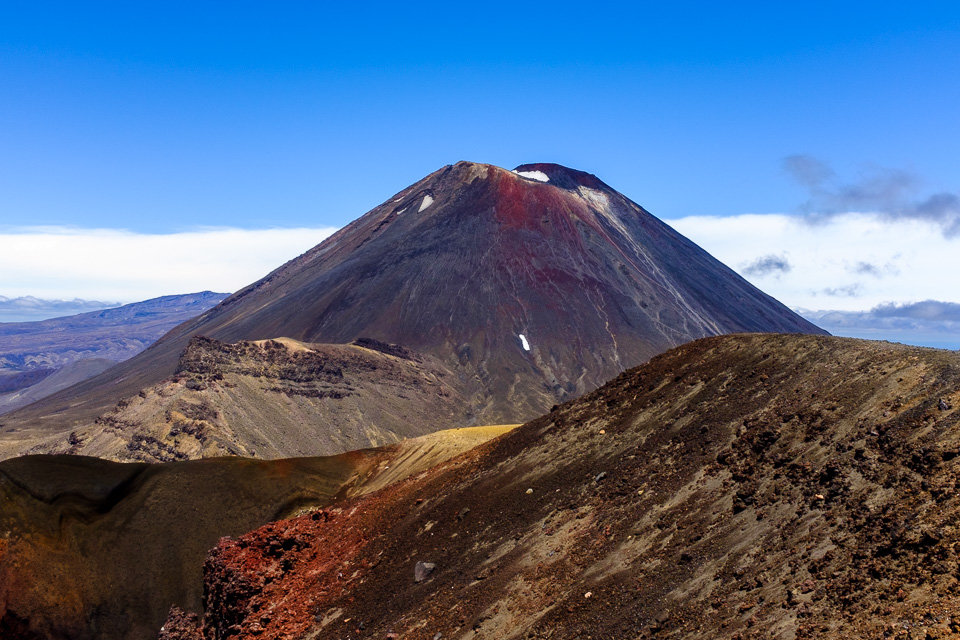
This year, Jakub was luckier about the weather and all highlights showed up in the summer sunshine.
One disadvantage of the track is its popularity itself. During the high season, there are heaps of tourists who climb up to the Red Crater as a long slow snake. Now and then, we were surprised what kind of clothes were people able to wear for such kind of track, when they were supposed to walk in debris.
Last year, as we organised an early shuttle, we avoided the crowd and walked through the Mangatepopo Valley up to the Soda Springs only with few other people. From that point, the people started to accumulate as the terrain got steeper and up to the Red Crater they already moved on as a giant snake.
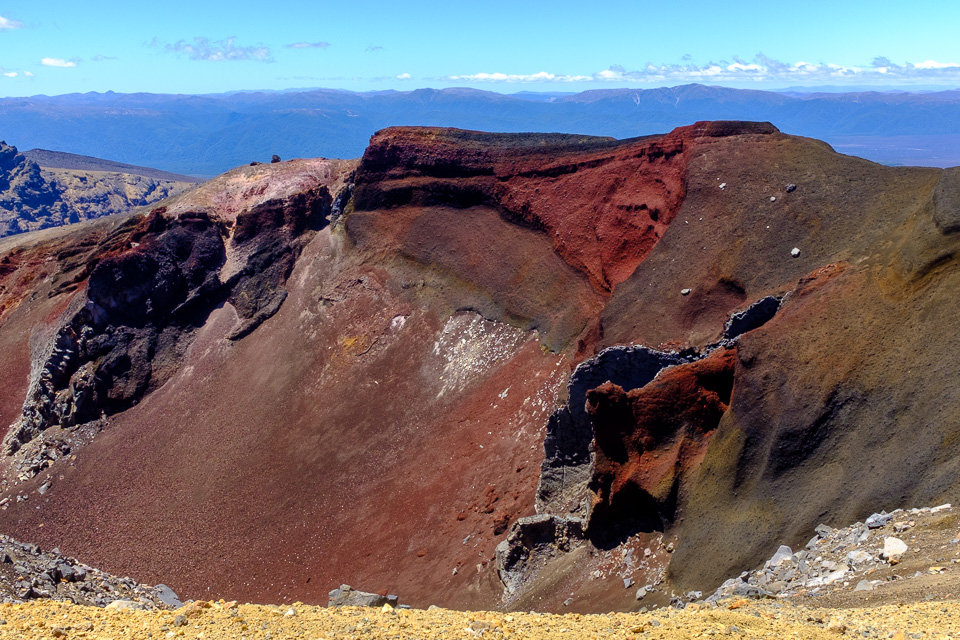
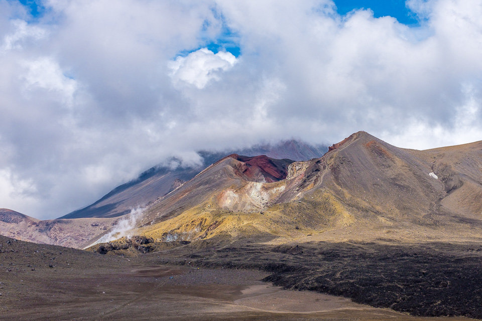
The highest point of crossing, the Red Crater, we had to pass without any good view as it was covered by clouds. We couldn’t see it, but we definitely could smell it!
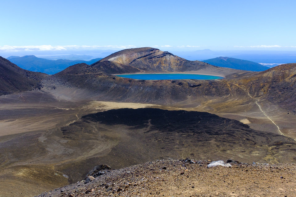
Suddenly, while we were sliding on debris down from Red Crater, the sun came out and the brilliant Emerald Lakes showed up. The giant snake stopped and the mass photography began.
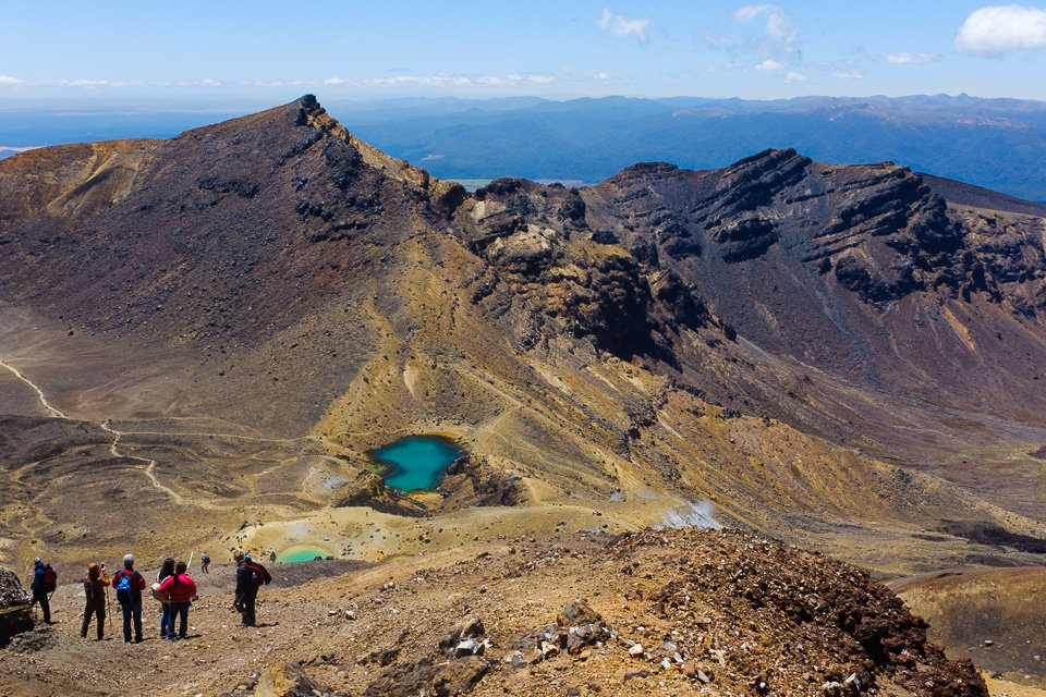
The crowd spread again as we walked across the Central Crater and once we passed the Blue Lake, the Red Crater appeared at the back so, at least, we could see it from the bottom when not from the top.
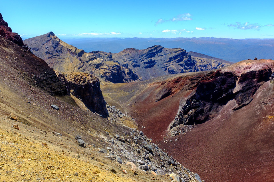
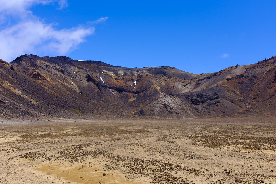
The rest of the track was a bit boring. Particularly because of dense clouds which covered everything all around and disabled any good views, but this part of the track was also long and same all the time. We did a quick stop at Ketetahi Hut, but then carried on with a fast pace to finish the track.

Eventually, almost at the same time as we finished the track, the sky cleared up. Now? At least, while the shuttle was driving us back to our accommodation, we had a great view of all the volcanoes. Moreover, as a bonus, we could see a small volcanic activity at a side vent of the volcano. A little compensation for bad weather.
P.S. The photos with the sunny weather were taken by Jakub this year when he did the crossing.