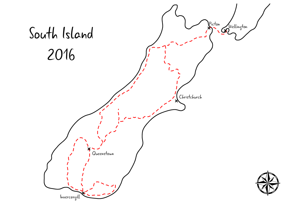
New Zealand South Island in 17 Days
- Date: 23.12.2016 - 9.1.2017
- Number of nights: 17
- Transport: car, ferry, walk
It was almost a three-weeks long Christmas break spent in South Island of New Zealand.
At first, we cruised by ferry and then drove further down south along the Inland Route, an alternative way after the earthquake in November 2016, where we met with our friends in Fairlie. Spending most of that time together, we explored the South Island’s landscape during sunny and rainy days, had a Christmas day BBQ, celebrated New Year’s Eve and the most importantly had a great time!
After New Year’s Eve our journeys split and from Glenorchy, we headed off down south to Catlins. Driving along Southland Scenic Route we admired rough coastline, wildlife (yes, we finally saw penguins!), amazing rainforest and heaps of waterfalls.
We completed our trip with the Routeburn Track, one of nine Great Walks and survived more than a nine-hours long drive back to Picton where we boarded on the midnight ferry and got back to Wellington.
Day 1
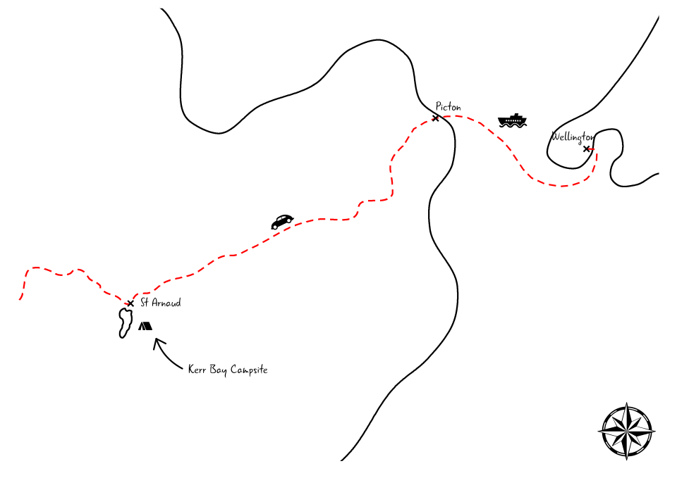
- Departure - Arrival: from Wellington to Nelson Lakes National Park
- Distance: ferry + 128 km
- Overnight: Kerr Bay Campsite
- Number of nights: 1
Day 2

- Departure - Arrival: from Nelson Lakes National Park to Fairlie
- Distance: 529 km
- Overnight: Fairlie Holiday Park
- Number of nights: 1
- Sightseeing on the way: Torlesse Wines, St James Walkway/Alpine Nature Walk, Forest Walk to Waterfalls, Maruia Falls
Day 3-4
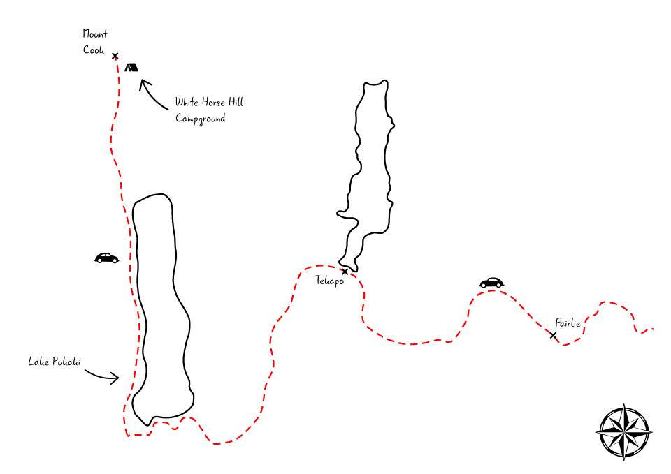
- Departure - Arrival: from Fairlie to Mt Cook
- Distance: 124 km
- Overnight: White Horse Hill Campground
- Number of nights: 2
- Sightseeing on the way: Lake Tekapo, Mt John Observatory, Lake Pukaki
Day 5-8
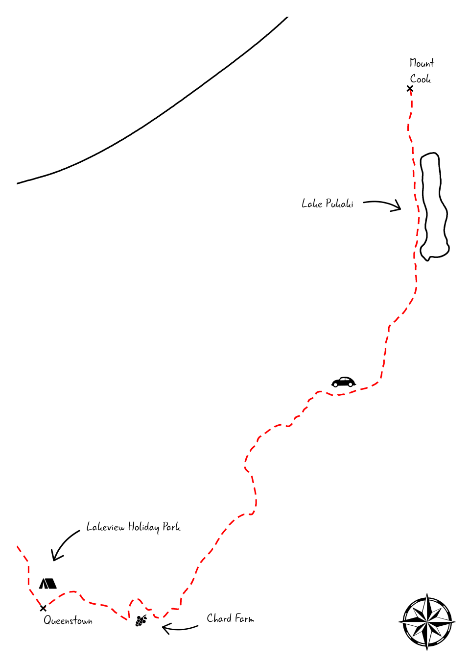
- Departure - Arrival: from Mt Cook to Queenstown
- Distance: 240 km
- Overnight: Lakeview Holiday Park
- Number of nights: 3
- Sightseeing on the way: Lindis Pass Summit, Chard Farm
Day 9-10
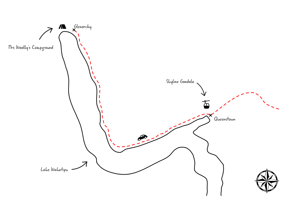
- Departure - Arrival: from Queenstown to Glenorchy
- Distance: 47 km
- Overnight: Mrs Woolly’s Campground
- Number of nights: 2
- Sightseeing on the way: Bennett’s Bluff Lookout
Day 11
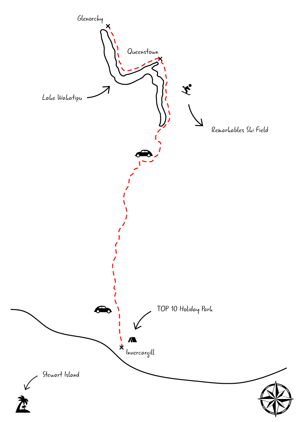
- Departure - Arrival: from Glenorchy to Invercargill
- Distance: 276 km
- Overnight: Invercargill TOP 10 Holiday Park
- Number of nights: 1
- Sightseeing on the way: Lake Wakatipu Lookout, Stirling Point International Signpost
Day 12
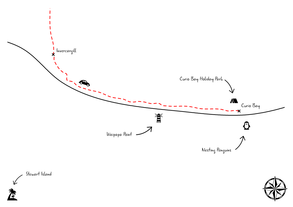
- Departure - Arrival: from Invercargill to Curio Bay
- Distance: 80 km
- Overnight: Curio Bay Holiday Park
- Number of nights: 1
- Sightseeing on the way: Matarua Estuary Lookout, Waipapa Point, Slope Point
Day 13
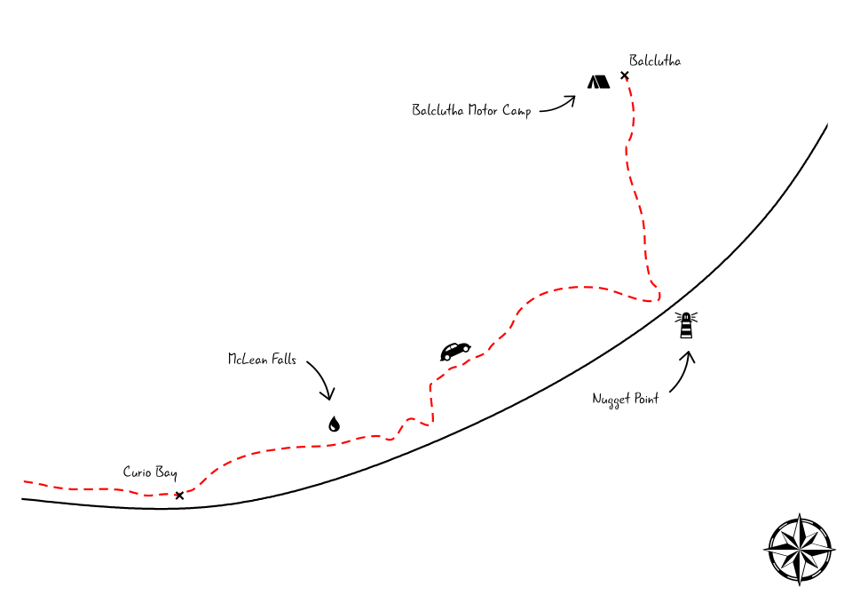
- Departure - Arrival: from Curio Bay to Balclutha
- Distance: 133 km
- Overnight: Balclutha Motor Camp
- Number of nights: 1
- Sightseeing on the way: Koropuku Falls, McLean Falls, Nugget Point, Lake Wilkie walk, Matai and Horseshoe Falls, Purakaunui Falls
Day 14
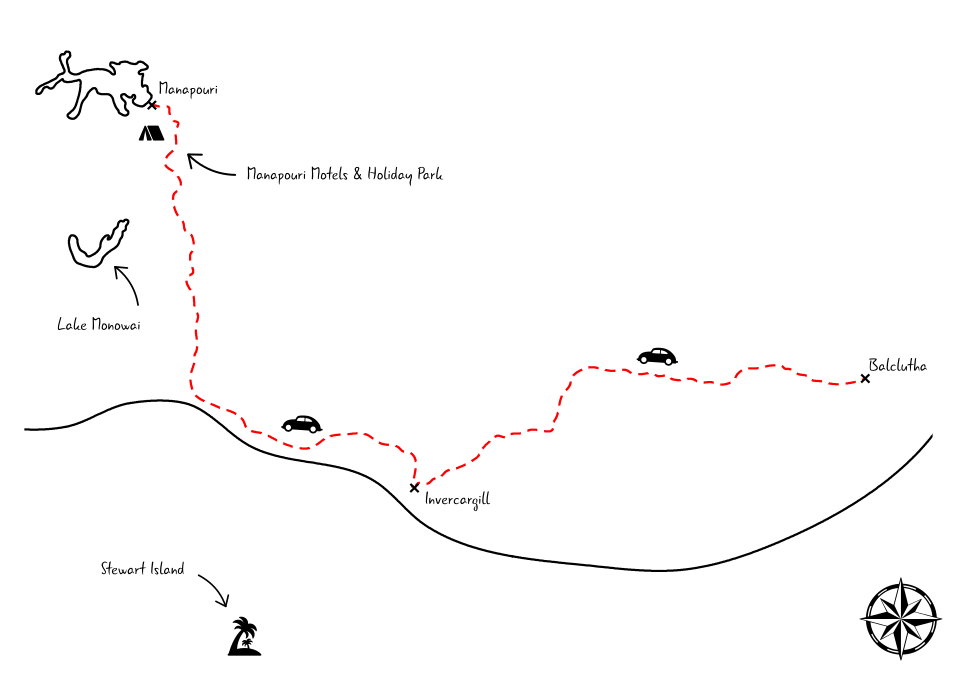
- Departure - Arrival: from Balclutha to Manapouri
- Distance: 291 km
- Overnight: Manapouri Motels & Holiday Park
- Number of nights: 1
- Sightseeing on the way: Lake Monowai, Clifden Suspension Bridge, McCracken’s lookout, Monkey island, Rakatu wetlands
Day 15
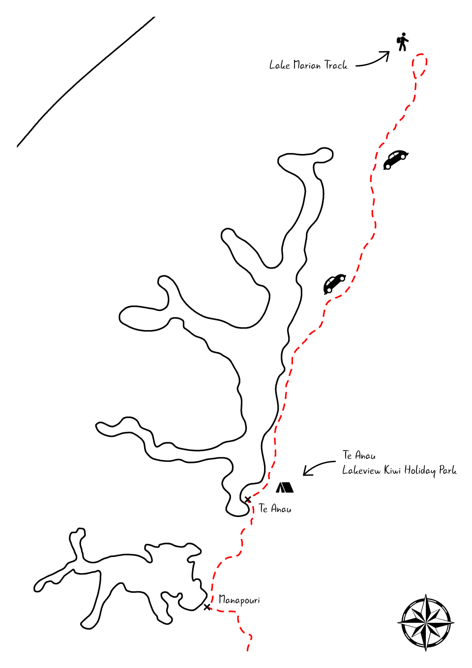
- Departure - Arrival: from Manapouri to Te Anau
- Distance: 21 km
- Overnight: Te Anau Lakeview Kiwi Holiday Park & Motels
- Number of nights: 1
Day 16
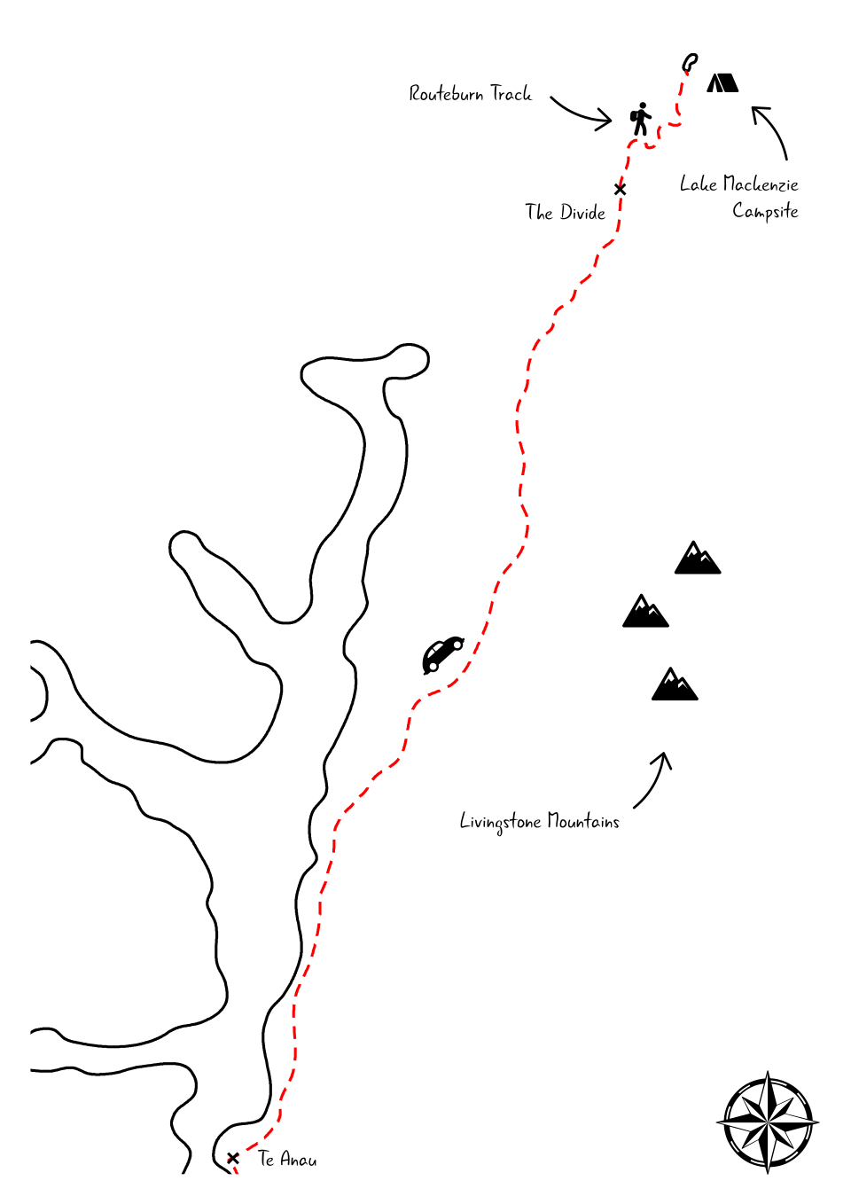
- Departure - Arrival: from Te Anau to Lake Mackenzie
- Distance: 85 + 12 km
- Overnight: Lake Mackenzie Campsite
- Number of nights: 1
Day 17
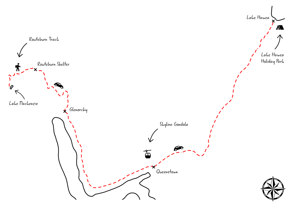
- Departure - Arrival: from Lake Mackenzie to Hawea
- Distance: 21 + 152 km
- Overnight: Lake Hawea Holiday Park
- Number of nights: 1
Day 18

- Departure - Arrival: from Hawea to Wellington
- Distance: 790 km + ferry
- Overnight: Bluebridge Ferry
- Number of nights: 1
Thanks to Freepik and Pixel perfect for the map icons and Brent Leimenstoll for the background.